Remote Sensing
Principles
January 18 (Wed)
Complementary readings:
Bolstad 2005 and NASA online tutorial
Remote Sensing and Maps
Seen
from mapness continuum: less abstraction (cf. topographic map) see I.3 (p. 6)
Seen
from map-making process: indirect experience (cf. ground survey)
Maps
can lie along different mapness continuum based on varying elements of three
defining characteristics of map (map scale, map projection, and map abstraction);
image of the earth is the important source of maps
Maps
can be made through either direct experience or indirect experience, and
actually through both; map-making requires ground survey (determining the
location of the earth; which again requires the full knowledge of the earth –
how it looks and how the location in the earth can be measured, which is the
subject of next week or so; see chapter 1, 3, 4, 5). With the invention of
aircraft and spacecraft, it became possible to observe the earth remotely with
a large geographic coverage.
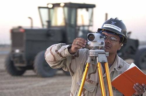
Map-making through direct
experience (Ground survey)
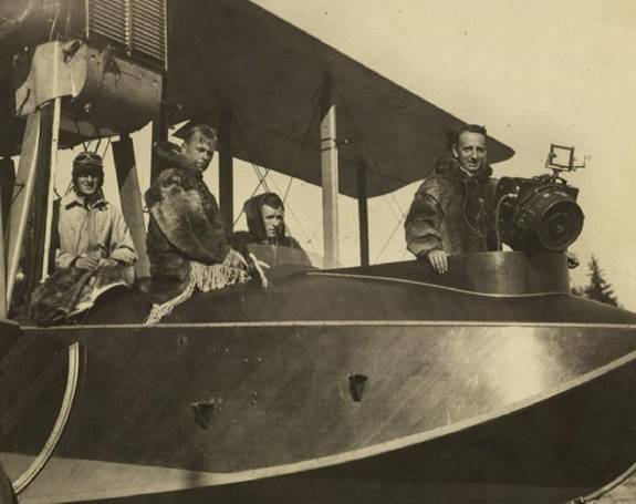
Map-making through indirect
experience (Remote sensing)
Principles of Remote
Sensing
Why
is the tree green?
To see something, we need three
elements: object (e.g. tree), energy source (e.g. sun light), and sensor (e.g.
human eye). When light strikes object, energy from the light is either
reflected or absorbed by the object (Figure 9.2). The amount of reflected
energy is the color perceived by your eye for example.
What you see is in essence
electromagnetic energy reflected by object where the energy travels in the form
of different wavelengths (→ electromagnetic
spectrum). If the energy in green spectrum is more reflected by the object
than energy in other spectrum, it appears green. See Figure 9.1
Electromagnetic spectrum can
be divided into spectral bands. Humans can only see visible light between 0.4
and 0.7 micrometer (millionth of 1 meter) in terms of wavelengths.
In remote sensing, sensor is
camera in aircraft or electronic recording instrument built in artificial
satellite, producing aerial photo and satellite imagery, respectively.
Pixel values in the image
represent the amount of electromagnetic energy reflected by the object given
spectral bands. The amount of electromagnetic energy reflected by the object
differs across electromagnetic spectrum (→ spectral signatures) See Figure 9.3
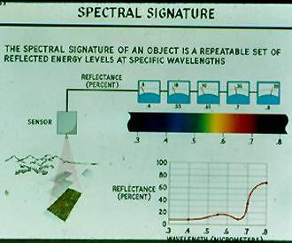
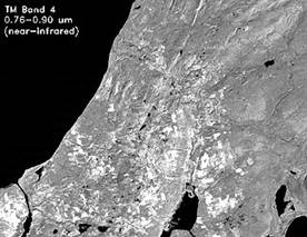
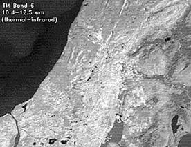
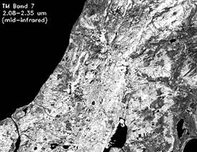
Spectral bands determine how
geographic features look; the amount of electromagnetic energy reflected by the
object varies as a function of varying wavelengths (i.e. spectral
signature).
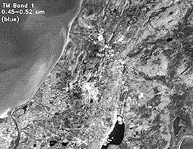
Combination of any 3 of the 7
bands on TM (Thematic Mapper: main sensor on Landsats 4 through 7) can be
assigned to one of the three primary colors: blue, green, red to yield a color
composite. If RGB is assigned to corresponding wavelengths respectively, a
color composite yields true-color image.
Otherwise, it yields false-color image.
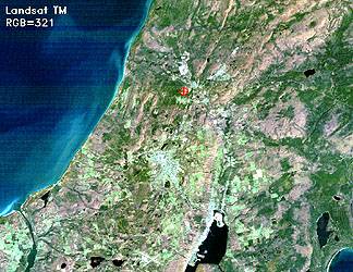 True-color image
See Plate 9.6
Why does vegetation appear
red?
Because infra-red band (band
7) is assigned to Red layer, and healthy vegetation exhibits high intensity of
reflected energy (shown in Figure 9.3). High intensity is translated into very
red color.
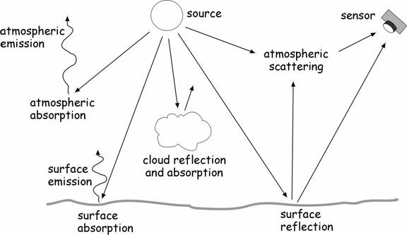
Not all of reflected energy
reaches the sensor. Certain wavelengths couldn’t penetrate water vapor
(clouds), carbon dioxide, ozone, and solid particles (dust for example).
Infrared and microwave provides transparent atmospheric window (see Figure 9.4), opening the potential for
developments in active sensor system such as Radar imaging (RADAR uses
microwave).
Three Key Aspects of
Resolutions of Remotely Sensed Imagery
Look
at description of satellite image or aerial photo in
·
Spatial: pixel
size (digital) or grain size (film)
·
Temporal: how
often (time interval) the image is updated
·
Spectral: which
spectral bands, how many spectral bands
These three resolutions are
important considerations for determining the fitness of use of data
More on Spectral Bands
·
Pancromatic image
– use a single band; black and white
·
Multispectral
image – use multiple bands 10; RGB and infrared
·
Hyperspectral
image – use multiple bands in an almost continuous range
Two Types of Sensor System
·
Passive: Sensor
system depends on external energy source (e.g. sun light); most of remote
sensing system
·
Active: Sensor system sends out radiation (like flash
camera), and receives reflected energy as well. (e.g. RADAR); can penetrate
water vapor (from atmospheric window, microwave exhibit transparent imaging window),
thus not influenced by weather condition, nighttime imaging is possible also